Enable High Contrast Mode
Disable High Contrast Mode
September 28, 2026
Subsurface Exploration of Wallkill River Sediment Deposits and Underlying Bedrock Through Electrical Resistivity Tomography Methods
By Sophia Schor
River Sediment Deposits and Underlying Bedrock Through Electrical Resistivity Tomography Methods In search of an area to conduct my senior research project as a geoscience student at SUNY Oswego while in New Paltz for the summer, I contacted the Wallkill Valley Land Trust and asked if they had any interesting land that I could survey using Electrical Resistivity techniques. Thanks to the wonderful help of Cara Gentry, data was collected at the Nyquist- Harcourt Wildlife Sanctuary using non-invasive Electrical Resistivity Imaging (ERI). ERI is a geophysical method used to examine the subsurface through monitoring differences in electrical resistance of the ground during low-level conduction. The device works by placing noncorrosive metal stakes into the ground a few inches deep and attaching them to a 360 ft long heavily insulated cable that connects to a resistivity meter. Safe levels of electricity (no more than an electric fence) are then sent into the ground, and the response is recorded by the instrument.
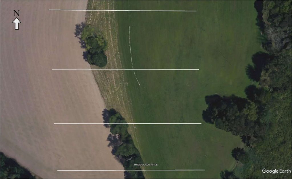
Position of Electrical Resistivity Lines run at Nyquist-Harcourt Wildlife Sanctuary
Small paths through the meadows were cleared to make way for the line to be run across
the meadow. Twenty-four metal stakes were placed in the ground and connected to the insulated
wire which ran east-west four times, each about 150 feet apart from each other in the north-south direction across Megan’s Meadow.
Using the results from this explorative method, conclusions about the composition of the
subsurface and water distribution can be made. Differences in resistivity across the subsurface of
the meadow can indicate changes in paleoenvironment. As the Nyquist-Harcourt Sanctuary sits
between the Wallkill River and an oxbow lake, the results of this study may indicate where the
bed of the Wallkill River was located in the past, as well as where point bank sediment was
deposited, and cut banks were eroded.
Conclusions about the underlying bedrock and distribution of water in the subsurface can
also be drawn from the results of the ERI techniques. When considering the local geology,
Nyquist-Harcourt sits within Devonian sedimentary strata, mostly shales, siltstones, and
sandstones. The results of this experiment can help to determine what sort of bedrock exactly is
underneath the sediments seen at the surface.
Through interpretation of the data that was collected over the summer, results may
include the location of the old stream channel that the Wallkill River once flowed through,
differences in sediment composition due to the location of the stream channel, water distribution
throughout the sediments, type of bedrock, and the depth or thicknesses of each of these features.
Final results and maps are coming soon! I am completing this work as my senior thesis
for my B.S. in Geology at SUNY Oswego. Here is a sneak peak at some of my progress!

This contour map depicts the depth to the bottom of the high resistivity layer that I have seen in my results.
A special thank you to Cara Gentry and the Wallkill Valley Land Trust for working with
me to make this project a reality. Thank you as well to Owen Schimmrich and Dave Hemroth for
help with setting up the equipment in the summer heat.
Interested in a property-specific scientific study? Contact us!